- Home
- Training Courses
- Membership
- About Us
- Instructors Blog
- December 2023: All I Want For Christmas
- November 2023: ESA Report Reviews
- October 2023: Can AI Write an ESA Report?
- September 2023: Getting Paid... or Not
- August 2023: Take Me Back...
- July 2023: To Bid or Not To Bid
- June 2023: Selecting a Supplier
- April 2023: Phase 1 Problems, Part 3
- March 2023: Phase 1 Problems, Part 2
- February 2023: Phase 1 Problems, Part 1
- January 2023: Working Outside in Winter
- 2022 Blogs
- 2021 Blogs
- December 2021: Asbestos in your Home
- Sept 2021: Dirty Jars And Other Bad Things… Part 2
- August 2021: Dirty Jars And Other Bad Things… Part 1
- July 2021: How do you want that drawing to look? Part 2
- June 2021: How Did You Want That Drawing To Look? Part 1
- April 2021: So You Need a RSC... Part 2
- March 2021: So You Need a RSC... Part 1
- February 2021: What's In Your Toolbox? Part 2
- January 2021: What's In Your Toolbox? Part 1
- 2020 Blogs
- December 2020: A Day in the Life, Part 2
- November 2020: A Day in the Life, Part 1
- October 2020: Exploring Your Career Path
- September 2020: So You Want To Start Your Own Business - Part 2
- August 2020- So You Want to Start Your Own Business
- June 2020: Effective Communication
- May 2020: Tips For Working From Home
- April 2020: Conducting ESA’s During a Pandemic
- March 2020: It's Not Easy Being Green
- February 2020: Looking Ahead; Bold Predictions for the Next Decade
- January 2020: Looking Back; A Decade in Review
- 2019 Blogs
- 2018 Blogs
- 2017 Blogs
- 2016 Blogs
- 2015 Blogs
- Find an AESAC Member
Menu- Home
- Training Courses
- » Training Courses
- » Webinar Series
- » Calendar of Events
- » Course Registration
- » Course Instructors
- » Testimonials
- Membership
- » Become a Member
- » Certifications
- » Membership Search
- » Update Member Profile
- » Members Only
- » » Member Login
- » » Membership Renewal
- » » Create/Change Password
- » » CESA Certification Application
- About Us
- » About AESAC
- » Course Instructors
- » Contact Us
- Instructors Blog
- » December 2023: All I Want For Christmas
- » November 2023: ESA Report Reviews
- » October 2023: Can AI Write an ESA Report?
- » September 2023: Getting Paid... or Not
- » August 2023: Take Me Back...
- » July 2023: To Bid or Not To Bid
- » June 2023: Selecting a Supplier
- » April 2023: Phase 1 Problems, Part 3
- » March 2023: Phase 1 Problems, Part 2
- » February 2023: Phase 1 Problems, Part 1
- » January 2023: Working Outside in Winter
- » 2022 Blogs
- » » December 2022: Advice To My Younger Self
- » » October 2022: Pre-Purchase Due Diligence
- » » Sept 2022: Words Matter
- » » July 2022: Let Us Come To You
- » » April 2022: Due Diligence
- » » March 2022: Time Management
- » » February 2022: Spinning Augers... Part 2
- » » January 2022: Spinning Augers... Part 1
- » 2021 Blogs
- » » December 2021: Asbestos in your Home
- » » Sept 2021: Dirty Jars And Other Bad Things… Part 2
- » » August 2021: Dirty Jars And Other Bad Things… Part 1
- » » July 2021: How do you want that drawing to look? Part 2
- » » June 2021: How Did You Want That Drawing To Look? Part 1
- » » April 2021: So You Need a RSC... Part 2
- » » March 2021: So You Need a RSC... Part 1
- » » February 2021: What's In Your Toolbox? Part 2
- » » January 2021: What's In Your Toolbox? Part 1
- » 2020 Blogs
- » » December 2020: A Day in the Life, Part 2
- » » November 2020: A Day in the Life, Part 1
- » » October 2020: Exploring Your Career Path
- » » September 2020: So You Want To Start Your Own Business - Part 2
- » » August 2020- So You Want to Start Your Own Business
- » » June 2020: Effective Communication
- » » May 2020: Tips For Working From Home
- » » April 2020: Conducting ESA’s During a Pandemic
- » » March 2020: It's Not Easy Being Green
- » » February 2020: Looking Ahead; Bold Predictions for the Next Decade
- » » January 2020: Looking Back; A Decade in Review
- » 2019 Blogs
- » » November 2019
- » » September 2019
- » » August 2019
- » » July 2019
- » » May 2019
- » » March 2019
- » » February 2019
- » » January 2019
- » 2018 Blogs
- » » November 2018
- » » October 2018
- » » September 2018
- » » August 2018
- » » July 2018
- » » June 2018
- » » May 2018
- » » March 2018
- » » February 2018
- » » January 2018
- » 2017 Blogs
- » » April 2017
- » » June 2017
- » » August 2017
- » » September 2017
- » » December 2017
- » 2016 Blogs
- » » October 2016
- » » September 2016
- » » August 2016
- » » July 2016
- » » June 2016
- » » March 2016
- » » January 2016
- » » December 2016
- » » November 2016
- » 2015 Blogs
- » » April 2015
- » » July 2015
- » » September 2015
- » » October 2015
- » » December 2015
- Find an AESAC Member
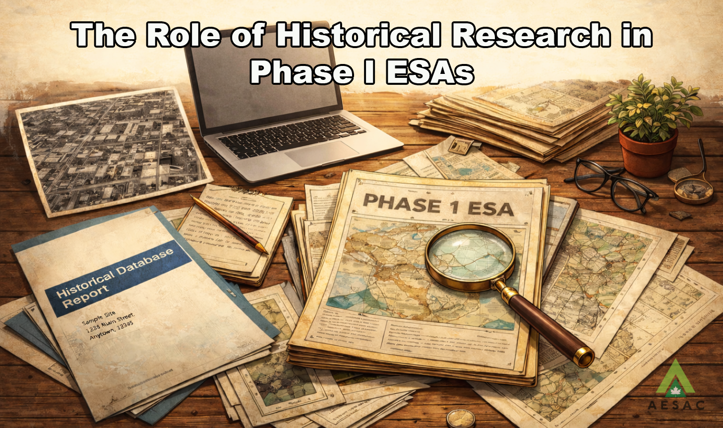
When many people think about historical research in a Phase I Environmental Site Assessment (ESA), aerial photographs are often the first source that comes to mind. While historical air photos are valuable tools, relying on them alone can result in an incomplete understanding of a property’s environmental risk profile.
Historical research in a Phase I ESA is not simply about identifying visible changes over time. It is about reconstructing land use, understanding regulatory context, and identifying potential environmental liabilities that may not be apparent from surface observations.
Beyond the Aerial Photograph
Aerial photographs provide useful insight into surface conditions, building footprints, vegetation patterns, and obvious site alterations. However, they have limitations:- Subsurface infrastructure such as underground storage tanks (USTs) is rarely visible.
- Temporary industrial activities may not leave obvious visual markers.
- Fill placement, grading, or minor spills may not be detectable.
- Resolution and frequency of historical coverage can vary significantly.
Aerial imagery tells part of the story; but rarely the entire story.
The Value of Documentary Research
Comprehensive historical research typically includes review of multiple documentary sources, such as:- Historical city directories
- Fire insurance plans (where available)
- Land title records
- Municipal building permits
- Historical topographic maps
- Regulatory databases
- Local knowledge and interviews
Each of these sources contributes a different layer of information. For example, city directories can reveal past occupants and business types that may indicate potential contaminating activities. Fire insurance plans can identify historical fuel storage or industrial operations not evident in photographs. Land titles may highlight ownership patterns associated with specific commercial uses.
Environmental risk is often linked to historical operations that predate modern environmental regulations. Without documentary research, these risks can remain undiscovered.
The Role of Environmental Database Reports
An essential component of modern historical research is the review of environmental database reports, such as those provided by Environmental Risk Information Services (ERIS).
ERIS Reports compile regulatory information from federal, provincial, and municipal sources, identifying nearby contaminated sites, fuel storage tanks, waste facilities, spill records, and other environmentally sensitive activities. In Alberta, this can include records from Alberta Environment and Protected Areas, the Alberta Energy Regulator, and other agencies.
The value of an ERIS Report lies not just in listing sites, but in supporting broader risk evaluation. For example:- Identifying adjacent or nearby fuel facilities that may present off-site migration risk.
- Confirming historical regulatory files associated with the subject property.
- Highlighting properties with historical contaminating activities that may influence site conditions.
Database reports are not substitutes for professional judgment. However, they provide a structured and comprehensive framework for identifying recognized environmental conditions (RECs) and potential areas of concern that may warrant further evaluation.
Reconstructing the Site’s Story
Effective historical research requires synthesis. It involves comparing aerial imagery with documentary evidence and regulatory data to identify inconsistencies, confirm uses, and evaluate plausibility.
For example:- Aerial photographs may show an undeveloped lot, while directories indicate a fuel distributor operating at that address.
- Land records may reveal subdivision changes that affect historical boundaries.
- Database reports may identify contamination at an adjacent property, requiring evaluation of groundwater flow direction and potential migration pathways.
The objective is not to collect documents for their own sake. The objective is to develop a defensible understanding of how the property has been used and whether those uses present environmental risk.
Professional Judgment and Defensibility
Historical research directly influences the defensibility of a Phase I ESA. Incomplete or superficial research can result in missed contaminating activities, inadequate risk evaluation, or unsupported conclusions.
Conversely, thorough and well-documented historical analysis strengthens:- Identification of recognized environmental conditions
- Development of the conceptual site model
- Rationale for conclusions and recommendations
- Overall credibility of the report
Environmental due diligence is ultimately about managing uncertainty. Historical research reduces that uncertainty by providing context and evidence.
Aerial photographs remain a valuable and accessible tool in Phase I ESAs. However, they represent only one component of a comprehensive historical review.
Robust historical research enables environmental professionals to move beyond surface observations and toward defensible, risk-informed conclusions.
In an era where environmental liability can have significant financial and regulatory implications, historical research is not simply a procedural step. It is foundational to competent environmental practice.
Sam Siegl, C.tech, CESASam is the founder and principal consultant of Nexus Environmental Services Ltd., based in Lethbridge, Alberta. With over a decade of dedicated experience in the environmental consulting industry, Sam specializes in Phase I, II, and III Environmental Site Assessments for commercial and industrial properties.
Sam can be reached at info@nexusenvironmental.ca

Training Courses
Membership
About Us
Contact UsCopyright (c) 2025 Associated Environmental Site Assessors of Canada; AESAC Inc.