- Home
- Training Courses
- Membership
- About Us
- Instructors Blog
- December 2023: All I Want For Christmas
- November 2023: ESA Report Reviews
- October 2023: Can AI Write an ESA Report?
- September 2023: Getting Paid... or Not
- August 2023: Take Me Back...
- July 2023: To Bid or Not To Bid
- June 2023: Selecting a Supplier
- April 2023: Phase 1 Problems, Part 3
- March 2023: Phase 1 Problems, Part 2
- February 2023: Phase 1 Problems, Part 1
- January 2023: Working Outside in Winter
- 2022 Blogs
- 2021 Blogs
- December 2021: Asbestos in your Home
- Sept 2021: Dirty Jars And Other Bad Things… Part 2
- August 2021: Dirty Jars And Other Bad Things… Part 1
- July 2021: How do you want that drawing to look? Part 2
- June 2021: How Did You Want That Drawing To Look? Part 1
- April 2021: So You Need a RSC... Part 2
- March 2021: So You Need a RSC... Part 1
- February 2021: What's In Your Toolbox? Part 2
- January 2021: What's In Your Toolbox? Part 1
- 2020 Blogs
- December 2020: A Day in the Life, Part 2
- November 2020: A Day in the Life, Part 1
- October 2020: Exploring Your Career Path
- September 2020: So You Want To Start Your Own Business - Part 2
- August 2020- So You Want to Start Your Own Business
- June 2020: Effective Communication
- May 2020: Tips For Working From Home
- April 2020: Conducting ESA’s During a Pandemic
- March 2020: It's Not Easy Being Green
- February 2020: Looking Ahead; Bold Predictions for the Next Decade
- January 2020: Looking Back; A Decade in Review
- 2019 Blogs
- 2018 Blogs
- 2017 Blogs
- 2016 Blogs
- 2015 Blogs
- Find an AESAC Member
Menu- Home
- Training Courses
- » Training Courses
- » Webinar Series
- » Calender of Events
- » Course Registration
- » Course Instructors
- » Testimonials
- Membership
- » Become a Member
- » Certifications
- » Membership Search
- » Update Member Profile
- » Members Only
- » » Member Login
- » » Membership Renewal
- » » Create/Change Password
- » » CESA Certification Application
- About Us
- » About AESAC
- » Course Instructors
- » Contact Us
- Instructors Blog
- » December 2023: All I Want For Christmas
- » November 2023: ESA Report Reviews
- » October 2023: Can AI Write an ESA Report?
- » September 2023: Getting Paid... or Not
- » August 2023: Take Me Back...
- » July 2023: To Bid or Not To Bid
- » June 2023: Selecting a Supplier
- » April 2023: Phase 1 Problems, Part 3
- » March 2023: Phase 1 Problems, Part 2
- » February 2023: Phase 1 Problems, Part 1
- » January 2023: Working Outside in Winter
- » 2022 Blogs
- » » December 2022: Advice To My Younger Self
- » » October 2022: Pre-Purchase Due Diligence
- » » Sept 2022: Words Matter
- » » July 2022: Let Us Come To You
- » » April 2022: Due Diligence
- » » March 2022: Time Management
- » » February 2022: Spinning Augers... Part 2
- » » January 2022: Spinning Augers... Part 1
- » 2021 Blogs
- » » December 2021: Asbestos in your Home
- » » Sept 2021: Dirty Jars And Other Bad Things… Part 2
- » » August 2021: Dirty Jars And Other Bad Things… Part 1
- » » July 2021: How do you want that drawing to look? Part 2
- » » June 2021: How Did You Want That Drawing To Look? Part 1
- » » April 2021: So You Need a RSC... Part 2
- » » March 2021: So You Need a RSC... Part 1
- » » February 2021: What's In Your Toolbox? Part 2
- » » January 2021: What's In Your Toolbox? Part 1
- » 2020 Blogs
- » » December 2020: A Day in the Life, Part 2
- » » November 2020: A Day in the Life, Part 1
- » » October 2020: Exploring Your Career Path
- » » September 2020: So You Want To Start Your Own Business - Part 2
- » » August 2020- So You Want to Start Your Own Business
- » » June 2020: Effective Communication
- » » May 2020: Tips For Working From Home
- » » April 2020: Conducting ESA’s During a Pandemic
- » » March 2020: It's Not Easy Being Green
- » » February 2020: Looking Ahead; Bold Predictions for the Next Decade
- » » January 2020: Looking Back; A Decade in Review
- » 2019 Blogs
- » » November 2019
- » » September 2019
- » » August 2019
- » » July 2019
- » » May 2019
- » » March 2019
- » » February 2019
- » » January 2019
- » 2018 Blogs
- » » November 2018
- » » October 2018
- » » September 2018
- » » August 2018
- » » July 2018
- » » June 2018
- » » May 2018
- » » March 2018
- » » February 2018
- » » January 2018
- » 2017 Blogs
- » » April 2017
- » » June 2017
- » » August 2017
- » » September 2017
- » » December 2017
- » 2016 Blogs
- » » October 2016
- » » September 2016
- » » August 2016
- » » July 2016
- » » June 2016
- » » March 2016
- » » January 2016
- » » December 2016
- » » November 2016
- » 2015 Blogs
- » » April 2015
- » » July 2015
- » » September 2015
- » » October 2015
- » » December 2015
- Find an AESAC Member
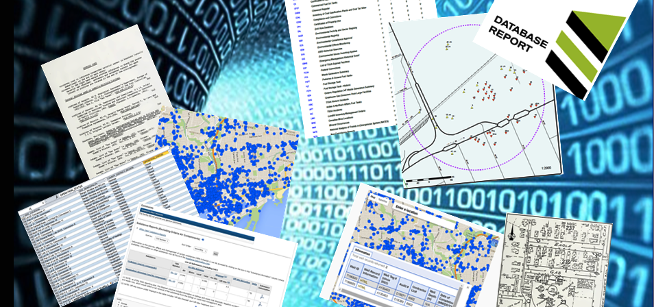
In my last article I discussed some of the research requirements for conducting a Phase 1 Environmental Site Assessment (ESA), in particular the use of environmental databases to confirm the history and development of a particular property, and to assist in determining potential environmental concerns that may impact the Site. One of the research tools I employ for every Phase 1 ESA I undertake is an environmental database report from Environmental Risk Information Services (ERIS).
Common Problems with Environmental Databases
I have observed a number of problems with environmental databases in general, and database managers like ERIS have also run into these issues; which can include:- Incorrectly entered original data (e.g. incorrect GIS coordinates).
- Insufficient or inaccurate original data (e.g. incomplete provincial well records).
- Wrong municipal address is used for the data search (e.g. Main St North vs. Main Street South).
- Historical changes in Street names (e.g. Main Street formerly called King Street), or changes in municipal address numbering.
- Too many databases and too much data can lead to possible data conflicts (e.g. data reported in a private database; but not in a regulatory database).
- Missing reference data (i.e. what do certain codes signify).
- Duplicate records, or out-of-date records that have not been updated at the source.
- Missing Unique Identifier for records - this makes it difficult to match records and identify records.
- Data still in paper copy or PDF which makes it difficult to extract the information.
- Absence of relevant data for the Site does not always mean there are no records, sometime you have to double check in several databases.
- When no data is returned for a database search or information request; nil results are still reportable.
“Data! Data! Data! I can’t make bricks without clay!” Sir Arthur Conan Doyle
Avoiding Database Pitfalls
I asked Mike Chester and Carolyn Inglis of ERIS to walk me through the steps ERIS takes to confirm data and vet their information prior to plotting and reporting, and to avoid some of the problems noted above. Data is analyzed when first received by ERIS to understand the data model and to ensure all records requested have been provided from the source database. This includes confirming the accuracy and usability of the supplied coordinates, checking for missing data fields, and any available updates. All database information (particularly coordinates) is dependent on the accuracy and validity of the original data entry in the source database. Procedures and techniques such as address cleansing software, geocoding and manually reviewing data sets are employed to screen for incorrect addresses, alternate and historical street names or other potential errors. As a last step the Report Analyst looks at all records within a report to ensure all data is plotted correctly.“True genius resides in the capacity for evaluation of uncertain, hazardous, and conflicting information.” Winston Churchill
A great deal of professional judgement is required to accurately assess the data and determine the reliability and relevance of the reported data with regards to the ESA property. Incorrectly interpreted data can sometimes lead to serious implications for the consultant and for ESA proponents and other stakeholders. In a future article I will discuss how you can properly interpret the data, and steps you can take to confirm the validity of your information when confusing or conflicting data is encountered.
By:
Bill Leedham, P. Geo., CESA, QPesaBill is the Head Instructor and Course Developer for the Associated Environmental Site Assessors of Canada (www.aesac.ca); and the founder and President of Down 2 Earth Environmental Services Inc. You can contact Bill at info@down2earthenvironmental.ca

In-House Training
Membership
About Us
Contact UsCopyright (c) 2026 Associated Environmental Site Assessors of Canada; AESAC Inc.